Mountain biking at Parc Massif du Sud in Saint-PhilémonMountain biking at Parc Massif du Sud in Saint-Philémone
©Mountain biking in Parc Massif du Sud|Philippe Toussaint
Bicycle enthusiast

Mountain biking…in the mountains!

Parc du Massif du Sud, Saint-Philémon


Philippe Toussaint, Parc Massif du SudPhilippe Toussaint, Parc Massif du Sud
©Philippe Toussaint, Parc Massif du Sud
Philippe Toussaint

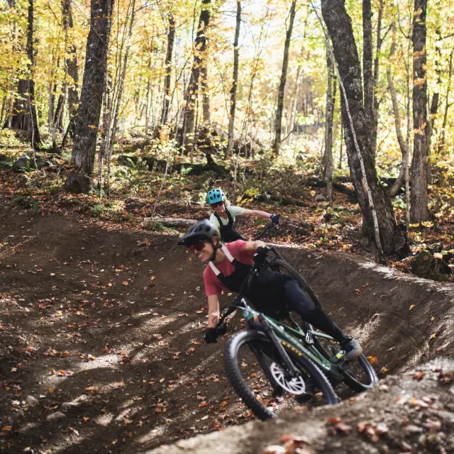
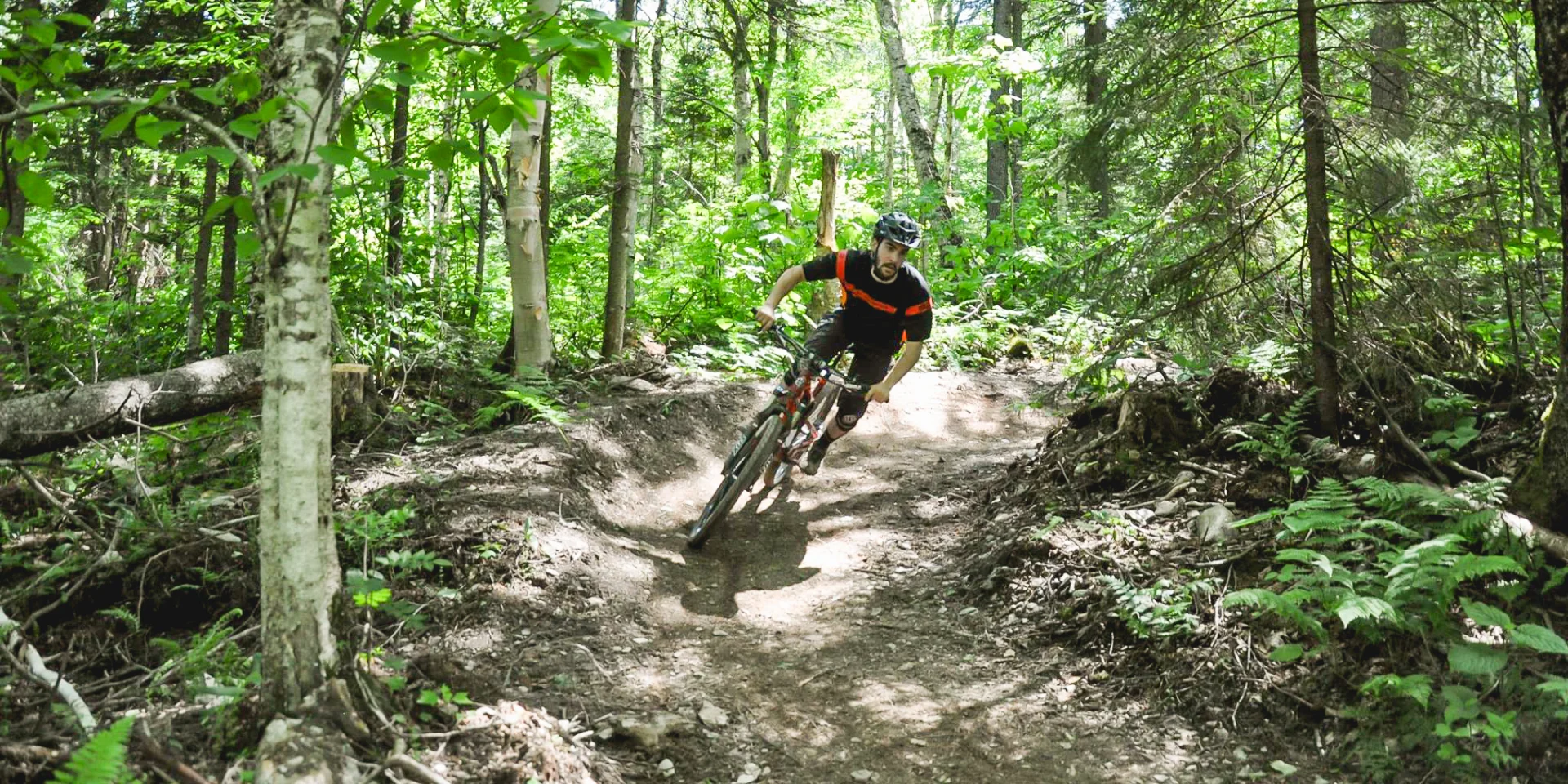
Parc du Massif du Sud’s mountain bike trails are part of the Park’s extensive range of activities. On the menu for mountain bikers: trails that are sometimes technical, sometimes rolling and, above all, accessible. It’s a trip south of Bellechasse that’s well worth the detour!

 My old office, a jewel!

I know, I may be a little biased… having previously been a Park employee, but aren’t I one of the best people to talk about our jewel? I took some friends there to show them the mountain bike trails. Let me tell you about our day.

“You’ll see, right from the start, it’s uphill!”

That’s what my work colleague said to my friends as we prepared to mount our bikes at the Welcome Pavilion. So they understood the name of the first trail: Engine Heater #1 (Length: 0.9 km – Elevation gain: +45 m, -0 m). There’s no doubt about it: we’ll be well and truly warmed up for the start of our cycling outing!

After this warm-up (the Chauffe-moteur is in a way the access trail to the network), we move on to Trail du Buck #2(Length: 2.2 km – Elevation gain: +45 m, -40 m), an intermediate-level trail, but nonetheless relatively accessible. The first section of the trail climbs gradually, but, as everything that goes up must eventually come down, the second section is very rolling, with several contoured turns and little jumps that put a big smile on our faces. The climb was well worth it!

 Ready for a more technical challenge!

We’re now warmed up and ready for a new challenge. And just what we need: the next trail we’re about to tackle – Serpentine #3 (Length: 1 km – Elevation gain: +30 m, -35 m) – is at an advanced level. There’s no doubt about it, the level has just gone up a notch! We go from a rock jump to several tight bends and from a narrow footbridge to several technical passages on rocks. Just as we were about to let our guard down, a large rocky cape gave us a few palpitations. No rest for the faint-hearted! In retrospect, the Serpentine is clearly the most technical trail in the park.

After the Serpentine, we move on to Robineuse #5 (Length: 0.7 km – Elevation gain: +5 m, -44 m) and the contrast is striking: a downhill trail, very rolling, with lots of contoured bends and undulations. There’s no monotony here: the variations from one trail to the next are very marked and much appreciated!

We then stop for a moment to analyze the trail map to find our bearings. With the geolocated trail map on theOndago app (for mobiles only), we know exactly where we are in the park. Good news! We’re right where we thought we’d be. Thanks technology!

See the trail map here.

 Vive les montées!

Rested and oriented, we decide to venture a little deeper into the heart of the park. We take the loooong ascent of Érablière #6 (Length: 2.4 km – Elevation gain: +107 m, -54 m) to join the Grandes Manœuvres trail.

As we leave the Érablière to take the Grandes Manœuvres #8 (Length: 0.7 km – Ascent: +35 m, -39 m), we’re torn between two options:

  1. Stay in the Maple Grove and enjoy its grandiose finale, with its beautiful, long descent to the river OR ;

  2. Turn right towards Les Grandes Manœuvres, which starts with… a climb!

With a trail name like that, “Les Grandes Manœuvres”, something tells us we’d be sorry to miss out. So we set off uphill on Les Grandes Manœuvres #8. It’s not long before we’re cheering ourselves on, dreaming of our planned stop later in the day at the Pub de la contrée and Bellechasse microbrewery, just a stone’s throw from the Park.

Fortunately, the climb soon gives way to undulating terrain, followed by the grand finale: a dizzying descent punctuated by huge contoured turns and a few jumps. The trail lives up to its name!

We then take Rebelle #9 (Length: 0.7 km – Vertical rise: +17 m, -27 m), an advanced trail, a little more technical, but still very pleasant and rolling. Along the way, we stop for a snack by the river, next to a small waterfall and a crystal-clear pool. It’s tempting to take a dip, but the freezing temperature of this water straight out of the mountains cools our ardor! That’s right! Even regular sports enthusiasts sometimes need a little motivation!

 A great final run!

To end the day, we decide to take the multifunctional E and C trails to the refuge du Milieu, where one of the park’s newest singletrack trails starts: Long Jeu #13 (Length: 2 km – Elevation gain: +10 m, -50 m).

The park boasts an impressive network of multifunctional trails (wide and gravelled) that are ideal for small families and cyclists less tempted by thrills. For more advanced cyclists, these trails serve mainly as connectors to the singletrack trails.

Long Jeu #13 lives up to expectations. Mostly downhill, this trail allows us to return to the welcome station without too much effort, ending with a section of contoured turns and descents in a coniferous forest – a nice contrast to the forests we’ve visited so far!

Parc du Massif du Sud’s mountain bike network is easy and pleasant to follow, with clear directions, beautiful scenery and a great variety of trails that should appeal to young children and more experienced cyclists alike.


In total, we cycled almost 15 km in around 3 hours, breaks included. With the travel time and the (almost obligatory…) stop at the Microbrasserie de Bellechasse on the way back, we can say mission accomplished when it comes to outdoor activities!

What’s your next mountain bike weekend like?

More stories