Crossing the Devost river bridge at Parc des Appalaches in Sainte-Lucie-de-BeauregardCrossing the Devost river bridge at Parc des Appalaches in Sainte-Lucie-de-Beauregard
©Crossing the Devost river bridge at Parc des Appalaches |Sarah Moore
Outdoor enthusiasts

3 days of self-guided hiking in the Appalachian Park

Sainte-Lucie-de-Beauregard
Sarah family- Fleuressance flower farm, Saint-AntoineSarah family- Fleuressance flower farm, Saint-Antoine
©floral farm, Saint-Antoine
Sarah Moore

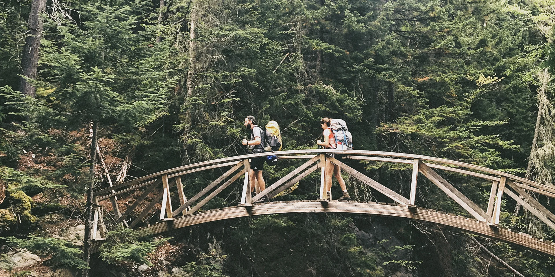
This summer, we bought our first house. A very light, three-seater tent. Light enough to carry everywhere on our backs. We also bought the mattress, sleeping bag, mess kit and dehydrated food. The important thing: everything had to fit in the rucksack. All that was missing was a plan, a real hike.

 The adventure begins

Our friends Laurence and Raphaël wanted to hike in the Chaudière-Appalaches region. I thought of the Parc des Appalaches and quickly got confirmation that anything was possible. Thanks to Stéphanie from Sainte-Lucie-de-Beauregard for the perfect 2-night, 3-day itinerary.

Saturday morning. Our bags were ready and so were our legs. Arriving in the Saint-Fabien-de-Panet area, we stopped at the hiker’s café for final questions. We made our way to the trailhead (KM26) and left a note in the car. Back at noon on Monday. This is where the adventure began. It was about 1 p.m.

 Day 1

Trails 8, 2, 3, 4 and 5
13 km
Finish: Campement de la Devost

A good climb for the first few km. We realize that we may have set off a little too late and that the hike will probably be longer than anticipated. It’s humid, but not very sunny. We’re well into the forest. The trails are very well signposted and there are several rest areas and observation sites. We take a few breaks, but we’re thinking more and more about our camp. The rays of sunshine at 5pm do us good. Nature is beautiful.

It’s around 6.40pm when we arrive at Devost. We’re not alone; we pitch our tents near the shelter and the boys decide to wash up in the river. We still have plenty of water for supper. On the menu: delicious Pad Thai with vegetables and peanuts from Quebec-based Happy Yak. A small fire and we’re off to bed. Burnt.

 Day 2

Sunday morning. We didn’t manage to get up as early as we thought we would. That wasn’t so bad. Now we had to deal with the water. Our men headed for the waterfall. After that, it took 40 minutes to treat the water (10 to brew and 30 before using it). No wonder we weren’t ready to put our boots back on. Coffee, lunch, preparation of lighter bags. 11 h. We’re on our way for at least 17 km.

Tour du Sugar Loaf (light without luggage)

Trails 10, 11 and 14

17 km loop

Happy, the day was looking good. Arriving at the observation point before the ascent of Sugar Loaf Mountain, we decided to make our way to the summit. You know, while we were at it. It was beautiful, a little rainy. In short, we still had more than halfway to go. By the time we’d taken a few photos, we were back down again. This is the trail where we met the most hikers. One of the most popular. Because on the others, you could feel quite alone in the world.

And we continued on the other trails. We came across some shelters, but no animals.

When we got to base camp, we took off our boots and everyone “bathed” with soap and minnows. We were lucky enough to get a free pedicure! We prepared a simple, tasty supper. I went to bed first. Apparently I missed the popcorn and marshmallows. The good old classics.

Honestly, after the day’s exertions, I’d have had a kombucha or a nice beer, but water was waiting for us. No big deal, I’ll enjoy it more next time.

 Day 3

Monday morning. Last day. Another 13 km to the car.

Return via trails 6 and 1

The first trail was beautiful, but demanding with many stumps to avoid. The second looked fairly new. Easier. It was perfect for our energy level. Sometimes we chatted, sometimes we were very quiet. And then there were moose calls or humans imitating moose. History will never tell. The last few km were the craziest. A little exhausted, we told each other stories about gnomes, songs to reply to, some thinking about poutine. In short, we talked loudly, were cheerful and, above all, proud of our three days in the wilderness.

When we got back to the car, a little exhausted, all we could think about was eating poutine. Our wish came true a few kilometers down the road at a perfect village snack bar.

Good to know:

Parc des Appalaches trails are free, as are rustic campsites like the one at Devost.

 Impressions from our friends Raphael and Laurence

Scope
The park wasn’t that crowded, which allowed us to enjoy some of the +/-160 km of trails with a sense of privacy. It was easy to feel disconnected from civilization, despite the proximity of roads through the park.

Signage
The maps, the trail welcome station and the signage all along the trails reassure the hiker. In particular, the large signs with trail descriptions and difficulty levels found at key points in the park give a good estimate of the scope of each segment.

Diversity
Despite the fact that we often find ourselves in the middle of the forest, the landscapes change. Sometimes surrounded by conifers, sometimes by deciduous trees, on the edge of a lake, at the summit of Sugar Loaf Mountain, the hiker can find something to suit him in many parts of the park. Still, you have to appreciate being in the middle of the forest for long distances.

Photos : Sarah Moore

More stories